Enzed Design:
Battle of Gettysburg Leadership Curriculum Maps
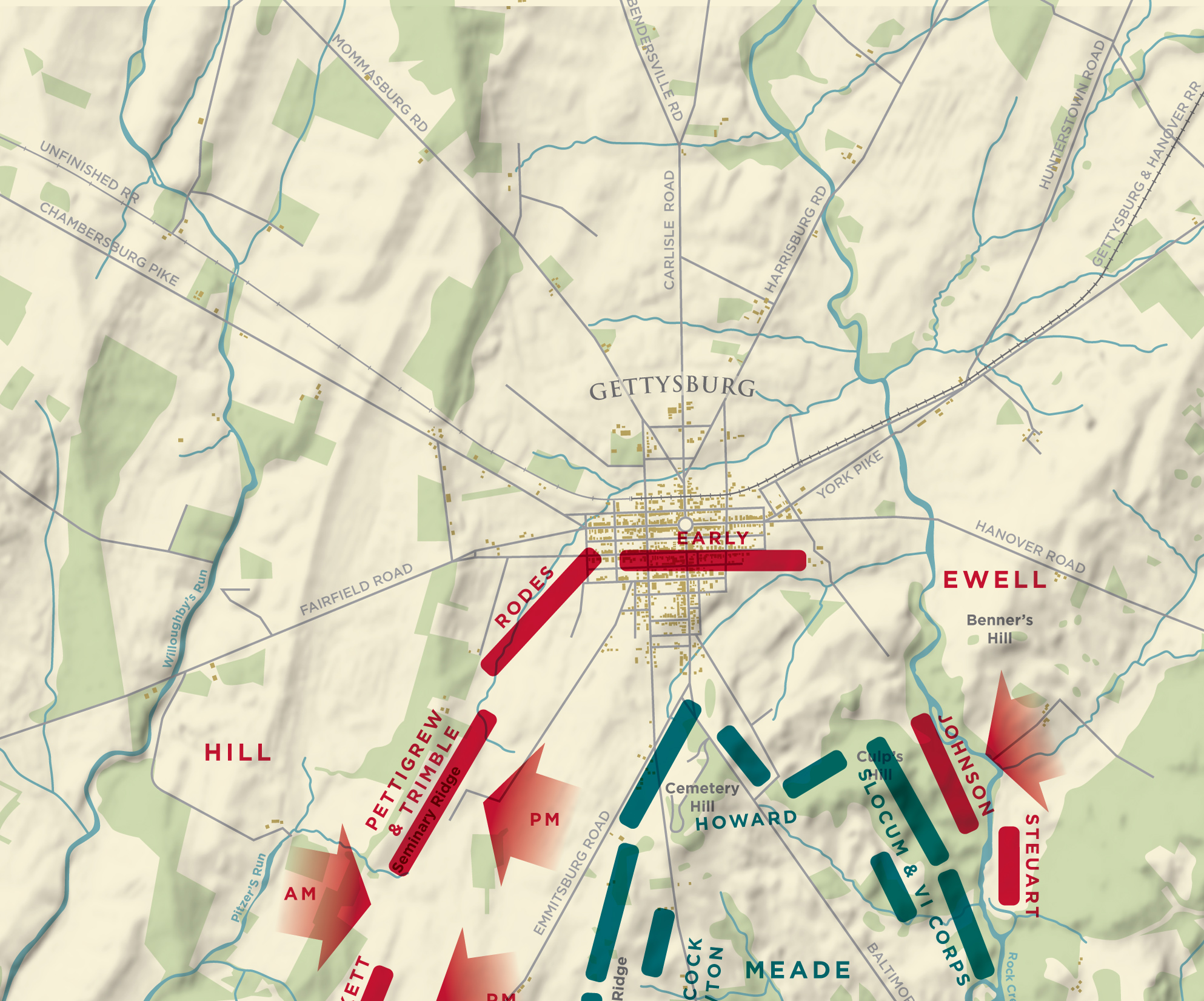
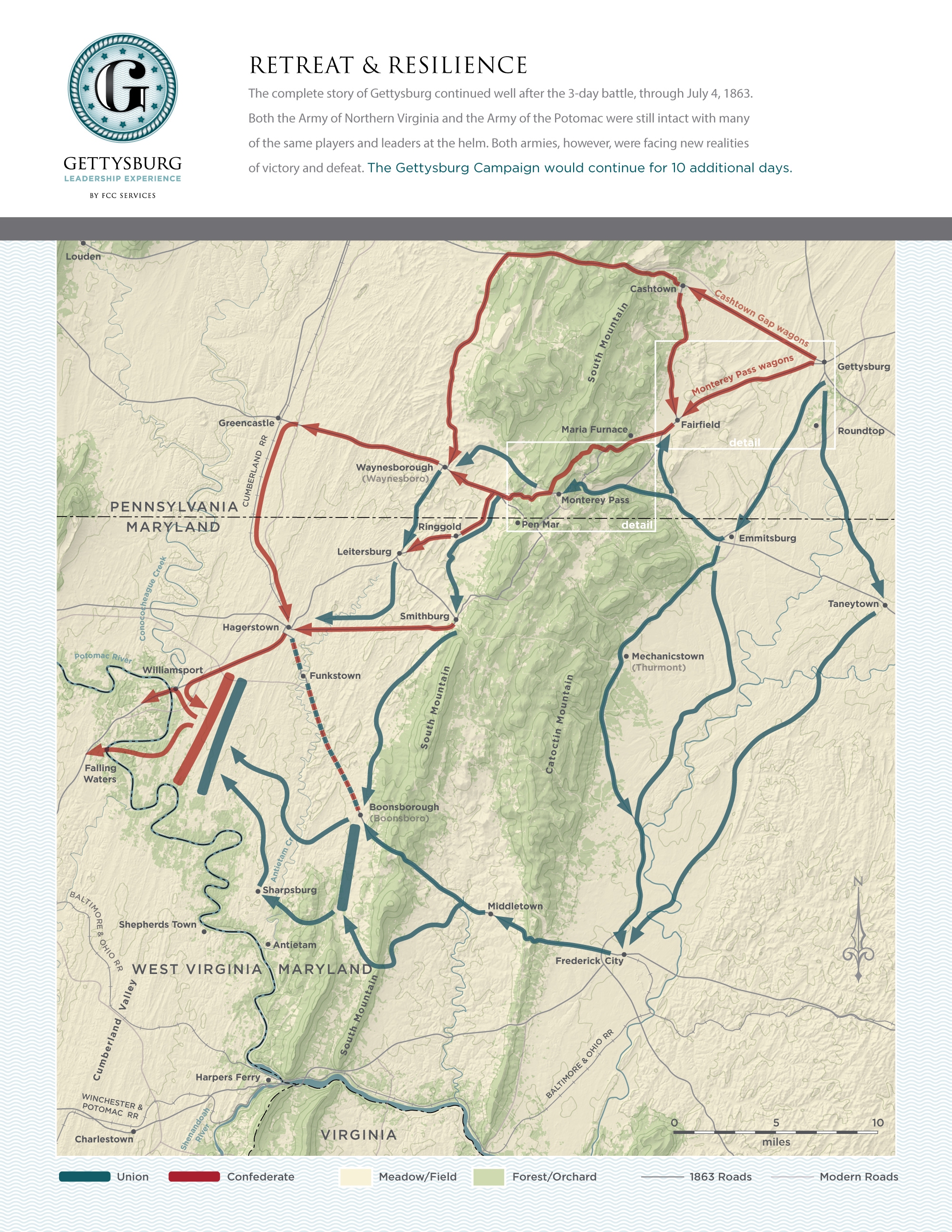
In 2014, I did a series of Battle of Gettysburg maps for a three-day professional Leadership Experience where C-level participants study the decision-making successes and failures during this pivotal three-day battle. The Experience was such a success that the organizers recently added Retreat and Resilience, a follow-up course detailing the post-battle ten-day Confederate retreat/Union pursuit, requiring three additional maps.
Information was sourced from a variety of copyright-free sources, including:
- USGS for digital elevation models (to generate shaded relief), contour lines, forest coverage
- OpenMaps for contemporary transportation, hydrography and political boundaries
- Library of Congress for historical towns, roads and troop movements